Product Description
These products are widely appreciated for its accurate design, quality, durability and outstanding performance. These find application in electrical component and their control panels. We offer :- Class room maps comparative wall atlas & reference maps of India (maps certified by survey of India & recommended by NCERT)- size (70x100 cms)
- Comparative wall atals of world (maps certified survey of India and recommended by NCERT- size (70x100cms)
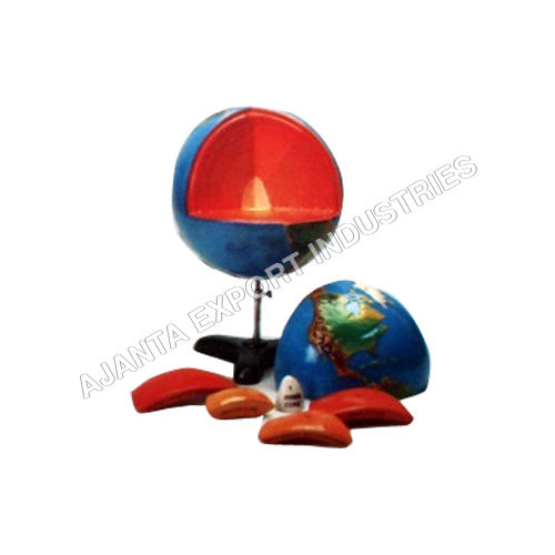
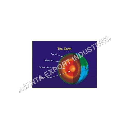
- Changing face of earth - size 50x75 cms
- Man & environment series - size 50x75 cms
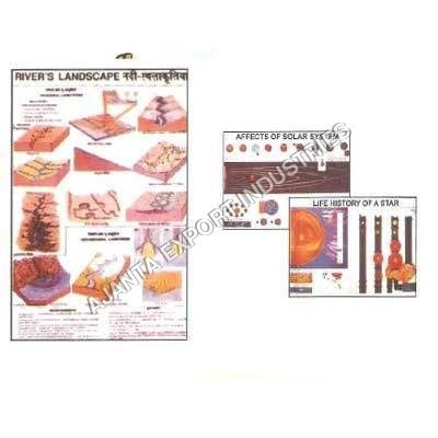
- Polyart plastic geographical and astronomical chart series - size (75x100 cms)
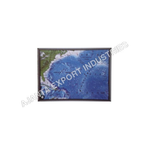
Comprehensive Geographic and Astronomical CoverageOur collection includes world maps, regional maps, constellation charts, and detailed astronomical diagrams, so users can explore earth's geography and the cosmos. These charts are designed to clarify complex information, making them perfect for educators, students, or anyone fascinated by maps and stars. Thanks to clear labeling and intelligent layout, navigation and understanding are straightforward.
Durable and User-Friendly DesignEngineered for repeated use, every map and chart features moisture resistance, water-resistant lamination, and wipe-clean surfaces. Sealed edges prevent wear, while UV-resistant inks maintain vivid colors over time. The charts are lightweight and easy to display using pin-up, adhesive, or magnetic options, making installation simple and adaptable to any space.
Versatility for Multiple SettingsIdeal for classrooms, research centers, libraries, exhibitions, and home study rooms, these printed charts support teaching, research, and presentations. Their elegant, rectangular shape and customizable sizes adapt seamlessly to educational or decorative settings, helping transform spaces into interactive learning environments.
FAQ's of Wall Atlases Maps & Astronomical Charts:
Q: How are these wall atlases, maps, and astronomical charts typically used?
A: These charts are commonly used for educational instruction, research, presentations, reference, and home study. They enhance learning in schools, colleges, and libraries, and can also serve as decorative and informative pieces in homes or offices.
Q: What mounting options are available for these charts?
A: You can mount the charts using pin-up, adhesive strips, or magnetic backing, depending on your display needs and wall surface. These options make installation straightforward and adaptable for different environments.
Q: When should I choose a custom map scale or size?
A: Custom map scales and sizes are ideal if you need specialized coverage or want to highlight specific regions or topics. This flexibility is beneficial for focused lessons, unique research projects, or fitting unique wall spaces.
Q: Where can I effectively display these charts?
A: The charts are suitable for classrooms, research centers, libraries, offices, seminar rooms, exhibitions, and homes. Their attractive design and robust materials make them suitable for frequent use in busy environments or as long-term decorative features.
Q: How do I clean and maintain these wall maps and charts?
A: Simply wipe the surface with a soft, damp cloth. The water-resistant lamination and sealed edges make the charts easy to maintain, preventing damage from moisture or regular handling.
Q: What are the main benefits of using these wall atlases and charts?
A: Users benefit from accurate cartographic data, vibrant colors, durability, and ease of use. They simplify complex information, encourage interactive learning, and offer a visually engaging way to study geography or astronomy in various settings.
Q: Can these charts be produced in languages other than English?
A: Yes, while English is the standard, other languages are available upon request, allowing customization to suit diverse educational or institutional needs.


 English
 Spanish
 French
 German
 Italian
 Chinese (Simplified)
 Japanese
 Korean
 Arabic
 Portuguese